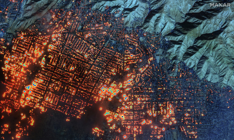
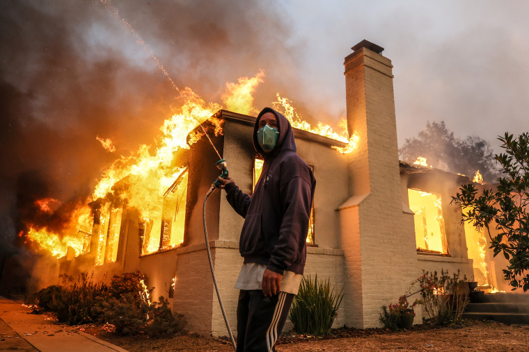
Fueled by powerful winds and dry conditions, a series of ferocious wildfires erupted Tuesday and roared across the Los Angeles area, destroying hundreds of homes and killing at least five people.
A Los Angeles County fire official said an untold number of significant injuries were linked to two of the fires, and a city official in Los Angeles described Tuesday night as "one of the most devastating and terrifying" that she had seen in her corner of the city.
"This is looking worse and worse the more information we get,” climate scientist Daniel swain said.
Here’s what we know about the fires.
Where are the fires?
- The Palisades Fire erupted Tuesday morning in Pacific Palisades, a Los Angeles County neighborhood east of Malibu, as a brush fire. The blaze had grown to more than 15,000 acres by Wednesday afternoon and to 17,234 acres by Thursday morning, according to the California Department of Forestry and Fire Protection. It's the most destructive fire in Los Angeles history.
- The Eaton Fire ignited Tuesday night near a canyon in the sprawling national forest lands north of downtown Los Angeles and had exploded to more than 10,000 acres by Wednesday, according to the U.s. Forest service.
- The Hurst Fire started Tuesday night in sylmar, a suburban neighborhood north of san Fernando, as a brush fire and quickly grew to 500 acres, Los Angeles Fire Chief Kristen Crowley said. By Wednesday evening it stretched 855 acres and was 10% contained, according to fire officials.
- The sunset Fire sparked in the Hollywood Hills of Los Angeles near Runyon Canyon shortly before 6 p.m. Wednesday, prompting mandatory evacuations. By Wednesday evening it stretched 60 acres, according to the Los Angeles Fire Department. The blaze was 100% contained as of Thursday afternoon, the city announced.
- The Lidia Fire broke out near the community of Acton in a region between the sierra Pelona and san Gabriel mountains Wednesday afternoon. By evening, it spanned 348 acres with 40% containment.

How many people are affected?
Nearly 180,000 people were under evacuation orders due to the Palisades, Eaton, Hurst and Lidia fires in Los Angeles County, Los Angeles County sheriff Robert Luna said Thursday.
Another 200,000 residents are under evacuation warnings.
More than 100,000 people have been evacuated, Pasadena Mayor Victor Gordo told reporters Wednesday in discussing the Eaton Fire, and 100,000 have been told they may need to evacuate because they live in a danger zone.
Roughly 37,000 people in the path of the Palisades Fire were ordered to leave their homes in the cities of Calabasas, Malibu and Los Angeles, law enforcement and fire officials said.
More than 3,000 people in the sylmar area were also under emergency evacuation orders, Crowley said.
Have there been deaths and injuries?
There have been significant injuries in the Eaton Fire, according to Los Angeles County Fire Chief Anthony Marrone.
As of Thursday, five people had died, four of them in the Eaton Fire.
Initially, officials said that five people had died in that fire, but on Thursday they said that preliminary number was wrong.
A fifth death was discovered Thursday in a residential building off the Pacific Coast Highway in connection with the Palisades Fire.
Officials are just beginning to access areas for welfare checks and missing person reports, and they warned that the death toll could grow.
Marrone said a significant number of people who did not heed evacuation orders have been injured in the Palisades Fire.
How much damage have the fires done?
"There is a lot of damage out there," Luna told reporters.
Marrone estimated that 1,000 homes and businesses have burned in the Palisades Fire and hundreds more in the Eaton Fire. Video from NBC Los Angeles showed several businesses in a busy commercial area in Altadena in flames, and the Pasadena Jewish Temple and Center burned overnight, the station reported.
Video from Malibu showed beachfront homes reduced to rubble.
The insured losses from this week’s fires may exceed $20 billion, and total economic losses could reach $50 billion, according to estimates published by JPMorgan on Thursday.
Those losses would far exceed the $12.5 billion in insured damages from the 2018 Camp Fire, which until now was the costliest blaze in the country’s history, according to data from Aon.
What led to the fires?
The combination of drought-like conditions — southern California has had less than 10% of average rainfall since Oct. 1 — and powerful offshore winds that hit the region Tuesday prompted fire weather that was, in the words of the National Weather service, "about as bad as it gets."
The agency issued a red flag warning — indicating an increased risk for fire danger — to 19 million people. Wind gusts topping 70 mph were recorded at several locations across the region.
swain pointed to the weather whiplash California has experienced in recent years — lurching between drought and heavy rainfall — and said such swings are a key element of the fire weather gripping the region.

“It’s not just that drier conditions are perpetually more likely in a warming climate," he said, according Inside Climate News. "It’s that this oscillation back and forth between states is something that is particularly consequential for wildfire risk in southern California."
When will the fire weather end?
Red flag warnings will remain in effect across parts of southern California until Friday. Marrone warned residents Wednesday that they remain in danger.
"Please prioritize your safety, as well as the well-being of those around you, as we come together to continue to get through this widespread disaster," he said.