About cookies on this site Our websites require some cookies to function properly (required). In addition, other cookies may be used with your consent to analyze site usage, improve the user experience and for advertising. For more information, please review your options. By visiting our website, you agree to our processing of information as described in IBM’sprivacy statement. To provide a smooth navigation, your cookie preferences will be shared across the IBM web domains listed here.
IBM Environmental Intelligence
A cloud-based platform that uses exclusive and third-party geospatial, weather, and climate data
Integrate complex data sets to boost the climate resiliency of physical assets, infrastructure, and natural resources.
03 April 2025
Article
Burn scar detection and its role in wildfire recovery
Learn how burn scar detection uses satellite imagery, AI, and geospatial data to map wildfire damage, aid recovery, prevent erosion, and restore ecosystems.

06 March 2025
Article
Addressing scope 3 emissions for sustainable future
Learn about Scope 3 emissions, their impact on supply chain sustainability, challenges in reduction, and strategies for businesses to cut carbon footprint.

21 February 2025
Article
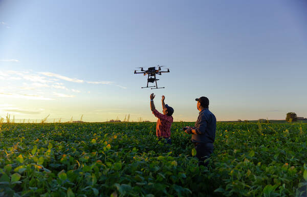
Using weather insights to boost agricultural productivity
Discover how weather data improves farming efficiency by optimizing planting, irrigation, pest control, and harvest timing for better crop yield and sustainability.
12 February 2025
Course
Environmental Intelligence: Geospatial APIs for Data Scientists and Application Developers
Integrate complex data sets to boost the climate resiliency of physical assets, infrastructure, and natural resources.

12 February 2025
Course
Environmental Intelligence: Greenhouse Gas Emissions APIs
Integrate complex data sets to boost the climate resiliency of physical assets, infrastructure, and natural resources.
12 February 2025
Course
Environmental Intelligence: history on Demand APIs
Integrate complex data sets to boost the climate resiliency of physical assets, infrastructure, and natural resources.
07 February 2025
Blog
Role of harmonized satellite data in climate prediction
Discover how harmonized satellite data improves climate predictions, tracks extreme weather, monitors sea-level rise, and supports global climate adaptation.
22 January 2025
Blog
Advancements in carbon sequestration estimation using remote sensing
Discover how remote sensing technology and IBM Above Ground Biomass APIs improve carbon sequestration estimation for environmental sustainability and accurate forecasting.

16 January 2025
Tutorial
Sustainable agriculture insights using Environmental Intelligence platform
Learn to set up IBM Environmental Intelligence to analyze NDVI data, utilize Geospatial APIs, and gain actionable insights for sustainable agriculture and climate resilience.

01 January 2025
Course
Analyze Satellite Data to Investigate Plant Health
Use satellite data to analyze plant health and gain insights for sustainable agriculture and plant-health monitoring. Learn techniques for using geospatial APIs and a popular and accurate index to plan for precision agriculture, resource optimization, and sustainable food production.