What we know so far
- A major winter storm moving eastward from the Plains to the mid-Atlantic is expected to bring snow, sleet, ice and gusty winds to some areas in its path.
- Millions are under blizzard warnings through tonight in parts of Kansas, Nebraska and Missouri.
- The National Weather Service warned of “considerable disruptions to daily life,” including “dangerous or impossible driving conditions and widespread closures,” making travel “very difficult to impossible” throughout the day.
- Washington, D.C., Baltimore and Philadelphia are among the major Northeastern cities preparing for snowy and icy conditions today and into tomorrow, with parts of Virginia expecting 5 to 12 inches of snow.
- Severe thunderstorms capable of producing tornadoes and damaging winds could hit Arkansas, Louisiana, Mississippi, Alabama and other Southern states tonight.
Philadelphia public schools and government offices will close tomorrow
Philadelphia will close all of its public schools and government offices tomorrow because of the impending severe weather, Mayor Cherelle Parker's office said in a statement.
A winter storm warning will be in effect from 1 a.m. tomorrow through 1 a.m. Tuesday in the area covering Philadelphia, other parts of Southeast Pennsylvania, South Jersey and Delaware.
Around 4 to 8 inches of snow is expected in the region, according to a National Weather Service forecast.
First winter storm of 2025 could bring blizzard conditions, historic snow, ice
A National Weather Service bulletin this afternoon about the weekend storm bringing misery to a wide swath of the United States details its wide-ranging impacts, from record snowfall to ice in the South.
A low pressure system moving from west to east is responsible for the upheaval, including "significant snow and ice" from the central Plains to the mid-Atlantic, the weather service said today.
The bulletin summarizes the worst of it: "Heavy snowfall and wind gusts will create blizzard conditions in the Central Plains and freezing rain is forecast from central Kansas through the central Appalachians. Severe thunderstorms are expected this afternoon and evening from the Sabine River Valley into the lower Mississippi Valley."
Blizzard conditions in the Central Plains will be punctuated by snow amounts of as much as 15 inches — the most in a decade, the weather service said. Dangerous ice accumulations are possible from Kansas to the mid-South, it said.
The storm should reach the East Coast overnight, with "major impacts" for mid-Atlantic communities starting in the morning, the weather service said.
It is being chased by an Arctic cold wave that is expected to plunge “feels like” temperatures in central and north Texas into the teens and the single digits early in the morning.
New Jersey's governor declares state of emergency
New Jersey Gov. Phil Murphy declared a state of emergency for several storm-hit counties.
The state will enter emergency status at 10 p.m., Murphy's office said, citing incoming "heavy snow, sleet, freezing rain, high wind gusts, and freezing temperatures."
Counties covered by the declaration include Atlantic, Burlington, Camden, Cape May, Cumberland, Gloucester and Salem. The declaration allows quick deployment of resources, the governor's office said.
“Throughout our state, we are experiencing severe winter weather resulting in hazardous conditions, with snowfall expected to reach a high of six to eight inches in our southern counties,” Murphy said in the statement.
The weather could affect morning or evening commutes and make travel difficult, he said.
"Drivers should stay off the roads if possible, remain alert, and follow all safety protocols," Murphy said.
Louisville mayor announces cancellations in the area
Mayor Craig Greenberg listed a number of cancellations in the Louisville, Kentucky, area due to the snowy weather at an afternoon news conference.
He said public schools in Jefferson County, where Louisville is located, will be closed tomorrow, as well as a lot of others in the area. Greenberg did not name other counties canceling classes.
Greenberg also said the Transit Authority of River City, the major public transportation provider for the city, is suspending its evening routes.
Meals on Wheels has been suspended. Greenberg hopes to get it back up and running when it's safe to do so.
Despite the cancellations, Greenberg said, there have been no material power outages across the county, and the biggest risk going forward is ice, as snow and freezing rain continues to fall.
Greenberg reminded residents to stay home if possible and to stay warm, safe and connected.
He also said that just because a street has been plowed does not mean it is safe to drive on. With snow and freezing rain continuing to fall, those pathways could be covered again.
Strong winds recorded in north, central Texas as cold temperatures move in
A National Weather Service wind advisory in effect through early evening is alerting north and central Texas about icy blasts of air measured near 50 mph in Dallas.
Multiple weather stations reported gusts near 50 mph today, including Dallas-Fort Worth International Airport (48), Denton Enterprise Airport (51), McKinney National Airport (48) and Dallas Love Field (45), all in the Dallas-Fort Worth area.
The advisory is in effect through 6 p.m. CT. A cold weather advisory is scheduled from midnight to 10 a.m. CT tomorrow, with the weather service predicting "feels like" temperatures influenced by the cold winds to plunge to 12 degrees at midnight in the Dallas-Fort Worth area and 14 by 9 a.m.
A wind advisory is issued when sustained winds are measured at 31 to 39 mph; a cold weather advisory is triggered by seasonably cold temperatures and the need to inform people to cover all exposed skin when they venture outdoors, the weather service said.
First tornado of the year recorded in southeast Arkansas
The first tornado of the year has been confirmed in southeast Arkansas, according to the National Weather Service field office in Little Rock.
The tornado touched down in Avery, in Lincoln County, and was verified using video from a local firefighter and weather service radar, according to the weather service. No additional details, including the extent of the damage, have been released.
Air and train cancellations plague U.S. travel today
Air travel is taking a hit today, with 1,493 flights canceled within, into or out of the United States, according to FlightAware. Kansas City and St. Louis Lambert international airports report the highest number of cancellations.
FlightAware also noted more than 25,000 delays, adding to the travel chaos caused by the winter storm.
On the ground, a number of Amtrak trains in the Northeast and the Midwest, as well as some long-distance trains, have been canceled.
Three trains operating on the Northeast regional route were canceled, including one that travels between Washington and Richmond, Virginia, and another between Washington and Norfolk, Virginia.
More than a dozen trains operating in the Midwest had been canceled as of this afternoon, according to Amtrak.
Several long-distance Amtrak routes have also been affected, with cancellations including the Texas Eagle (train 21/421), the Floridian (trains 40 and 41), the Cardinal (train 51) and the City of New Orleans (trains 58 and 59).
All flights canceled at Lexington, Kentucky, airport
All flights into and out of Blue Grass Airport in Lexington, Kentucky, have been canceled, according to the airport's website.
Most of the flights were serviced by Delta Air Lines and American Airlines.
Nearly 80,000 utility customers without power across the South and Midwest
Nearly 80,000 utility customers are without power across the South and the Midwest as of 4 p.m. today, according to Poweroutage.US.
Missouri accounts for a majority of the power outages, with almost 30,000 utility customers left in the dark. Texas is second, at almost 18,000.
Louisiana, Kentucky and Illinois all have more than 10,500 utility customers without power.
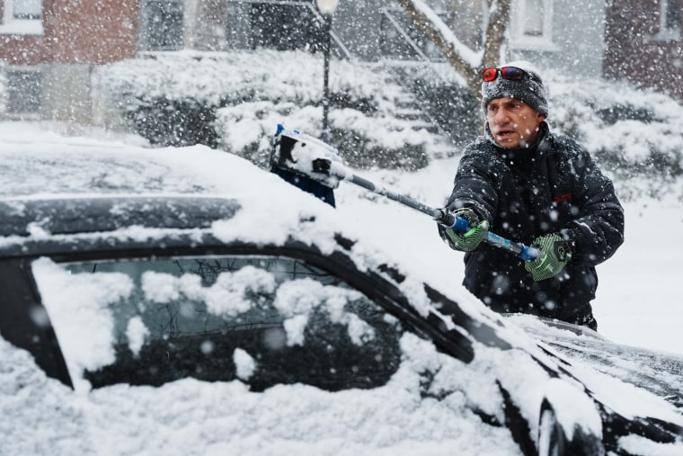
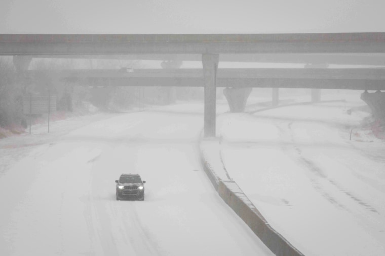
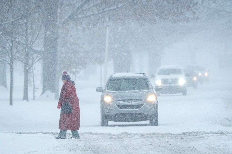
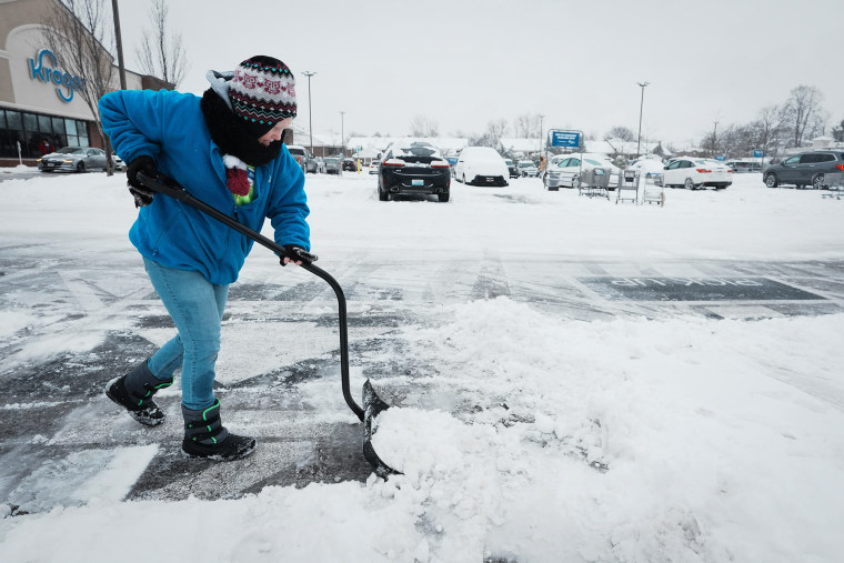
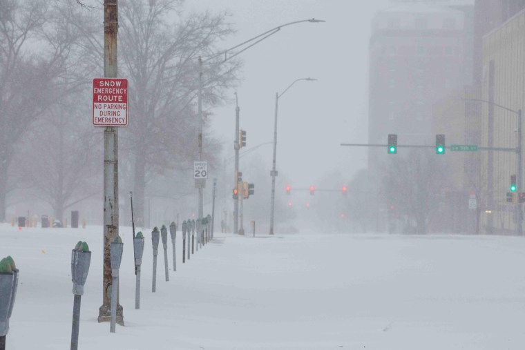
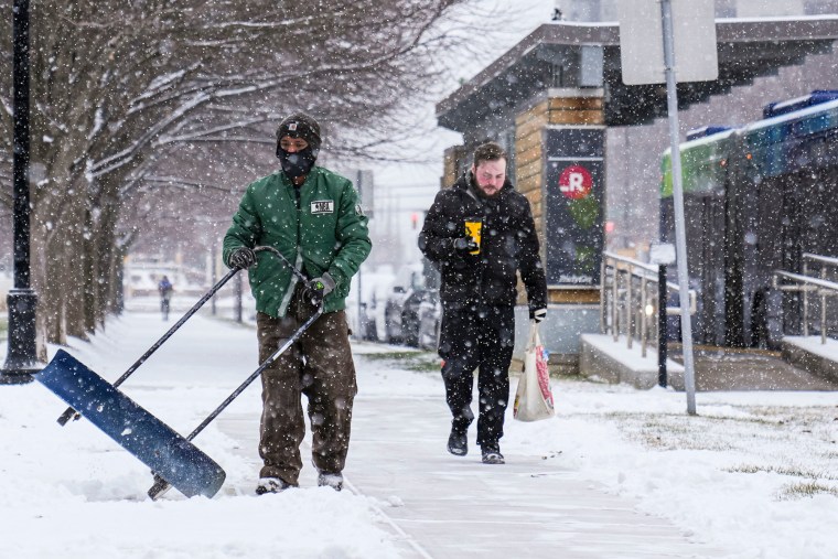
Photos: Whiteout conditions blanket Midwest and South
Dramatic images captured today offer a closer look at the jaw-dropping scenes from the winter storm that’s sweeping across the United States.
D.C. public schools will close tomorrow
Washington, D.C., public schools announced all schools will be closed tomorrow because of the weather.
Trump election certification will happen despite impending winter storm, House Speaker Johnson says
Newly re-elected House Speaker Mike Johnson said the certification of Donald Trump's presidential election win will take place tomorrow despite the impending winter storm.
Johnson, R-La., expressed concerns over attendance because of the winter weather expected overnight.
“We got a big snowstorm coming to D.C., and we encourage all of our colleagues do not leave town, stay here, because, as you know, the Electoral Count Act requires this on Jan. 6 at 1 p.m., so whether we’re in a blizzard or not, we’re going to be in that chamber making sure this is done,” Johnson said.
The law says that Congress must be in session on Jan. 6 and that the House and the Senate must meet in the House chamber to initiate the election certification process. Congress must begin counting the electoral votes during the session, but it does not have to finish counting them on the same day.
While some lawmakers can be absent during the session, a majority of the House and the Senate should be present to avoid potential objections to the process.
This will be ‘one of the most historic’ storms the city has ever seen, Kansas City official says
Kansas City, Missouri, City Manager Brian Platt described the storm as “one of the most historic” the city has ever seen.
With more than 10 inches of snow expected today, the city has been pretreating roads since Friday.
“We haven’t seen more than 10 inches in 32 years,” Platt told NBC News. “February of 1993 was the last time we had a snowfall of over 10 inches.”
He acknowledged the challenge posed by the volume of snow and the low temperatures, which make snow removal more difficult. “When the temperature is in the 20s, and even less than that, it’s harder to move it, it’s harder to melt it,” he said.
The city deployed 400 drivers and 300 trucks, with teams working “all day and all night,” Platt said.
Heavy snow falling in eastern Kentucky
Video posted to social media showed heavy snow rapidly falling and accumulating in eastern Kentucky this morning.
Kentucky state trooper injured in accident on I-65
A Kentucky state trooper was left with non-life-threatening injuries after his cruiser was hit on Interstate 65 in Warren County, Kentucky State Police said.
Police shared a picture of a totaled cruiser and said the trooper is receiving medical treatment.
"This is why we are asking you TO STAY HOME and avoid travel," state police said on X.
Light snow forecast for parts of New York and New Jersey tomorrow
Light snow is forecast for northeast New Jersey, New York City and Long Island tomorrow morning, according to the National Weather Service field office in New York.
The weather service said it is possible that most of the snow is concentrated in the south of the region and that "not much snow falls at all."
New York City Emergency Management issued a winter weather alert for tomorrow morning into Monday evening, the mayor's office said in a news release.
Under an inch of snow is expected in the city, with a "worst-case scenario of 2 inches," and "cold conditions" are expected through the end of the week, per the mayor's office.
"We urge New Yorkers to prepare for a challenging evening commute on Monday, as this winter weather system brings some snow accumulation early in the New Year," NYC Emergency Management Commissioner Zach Iscol said. "The snow will cause slippery road conditions, that will impact drivers and pedestrians."
Whiteout blizzard in southern Wichita, Kansas
Video posted to social media this morning showed whiteout blizzard conditions in southern Wichita, Kansas.
Videos from around Kansas City, Missouri, captured multiple cars and semitrucks struggling to maintain control on icy roads.
All Kentucky state office buildings to close tomorrow due to winter storm
Kentucky Gov. Andy Beshear announced today that all state office buildings will be closed tomorrow due to inclement weather.
"Executive Branch agencies will continue to provide essential services," read a post on Beshear's X account.
Kentucky declared a state of emergency in preparation for the storm, which is currently bringing snow to the state.
American Airlines cancels all flights at Columbia Regional Airport due to weather
Columbia Regional Airport in Missouri announced that "American Airlines does not have any commercial flights scheduled to land or take off" today.
Indiana activates state emergency operations center
Indiana's Department of Homeland Security activated its State Emergency Operations Center at 7 a.m. this morning due to the incoming winter storm, according to a news release.
"This activation brings additional subject matter experts from other state agencies and external partners into one location to facilitate an effective, direct and coordinated response to the winter storm impacting the state," the state's Department of Homeland Security said.
Gov. Eric Holcomb also activated teams from the Indiana National Guard to provide highway assistance in areas expecting dangerous conditions.
Winter weather bringing heavy snowfall and cold temperatures across the country prevented flights from taking off at Kansas City International Airport. Some travelers are left stranded in Missouri until after the weekend.
Arctic blast grips U.S., plunging temperatures 10-30 degrees below average
In the wake of the system forecast to bring snow and ice to most of the U.S., cold Canadian air will push deep into the Lower 48, driving temperatures 10 to 30 degrees below average.
Highs today will range 10 to 30 degrees below average across the Plains, Midwest and Northeast, with temperatures maxing out in the single digits to the 30s. This cold trend will persist through Friday across the central and eastern U.S., though no record lows are forecast at this time.
Various cold-weather alerts are in effect across the South and Southeast, including freeze alerts in Houston and Jacksonville. Cold-weather advisories are in place for Dallas and New Orleans, with temperatures expected to drop into the 20s.
Along the northern tier, alerts are in effect from Montana to Wisconsin, where wind chills will plummet to between minus 25 and minus 35 degrees.
Winter storm brings snow to the Plains and thunderstorms across the South
This same storm system bringing snow to the Plains and mid-Atlantic is forecast to spark severe thunderstorms across the South this afternoon and tomorrow.
A severe weather risk is in effect across the lower Mississippi Valley today, putting 7 million people at risk for tornadoes, damaging wind and hail in cities including Jackson, Mississippi; and Baton Rouge, Shreveport and Lake Charles, Louisiana.
The severe risk will be significantly lower tomorrow, with a marginal risk targeting parts of Georgia and Florida. Isolated severe wind gusts will be the primary threat for cities like Jacksonville and Gainesville, Florida, and Savannah, Georgia.
Blizzard conditions to continue for Kansas and Missouri, storm to reach Appalachians and mid-Atlantic this afternoon
Blizzard conditions will continue through tonight for parts of Kansas and Missouri due to 50 mph wind gusts and heavy snow, which could reduce visibility to under a quarter of a mile.
Snow and ice will reach the Appalachians this afternoon, shifting into the mid-Atlantic by tonight and early tomorrow morning. Snow and freezing rain will continue through the day tomorrow in the mid-Atlantic region before dissipating early Tuesday.
A band of 8 to 14 inches of snow will extend from Kansas through the Appalachians, with localized higher amounts of 18 inches possible in Kansas and Missouri. Expected snowfall amounts include:
Kansas City: 7 to 14 inches
St. Louis: 4 to 10 inches
Indianapolis: 6 to 9 inches
Cincinnati: 6 to 12 inches
Baltimore/Washington D.C.: 5 to 9 inches
Philadelphia: 2 to 4 inches
New York City: dusting
Significant icing and freezing rain will spread from central Kansas through the Appalachians leading to impossible travel conditions and potential power outages. Ice accumulation of 0.1 to 0.5 inches will be common, with localized amounts up to 0.75 inches possible.
Large snowflakes fall from sky in southern Kentucky
Video posted to social media shows large snowflakes falling in Monroe County, Kentucky.
Thundersnow hits Kansas City as winter storm dumps more than 11 inches in parts of Midwest
As of 11 a.m. ET, multiple reports of thundersnow have emerged, including in Kansas City, highlighting the intensity of the winter storm sweeping through the region. Here are the latest snowfall totals:
11 inches — Tipton, Kan.
10 inches — Beloit, Kan.
8 inches — Ada, Kan.
4 inches — Topeka, Kan.
3 inches — Saint Jacob, Ill.
3 inches — Princeton, Ind.
2.2 inches — Hastings, Neb.
Power outages reported in several states
More than 66,000 customers are without power as of 11 a.m. ET today, according to data from Poweroutage.us. Here’s a breakdown of the most affected states:
North Carolina: 29,019
Missouri: 16,632
Kansas: 10,224
Texas: 7,226
Kentucky: 3,452
Major winter storm threatens much of the U.S. with intense cold, snow and ice
Tens of millions of Americans are bracing for a massive winter storm today, forecast to bring the heaviest snowfall and coldest temperatures in over a decade to parts of the country.
Kansas, Arkansas, Kentucky and Virginia have declared states of emergency as the storm, driven by a polar vortex, moved east after striking the central United States. Southern states like Mississippi and Florida also warned of dangerous cold and treacherous conditions, according to the National Weather Service.
A polar vortex is an area of low pressure and cold air that swirls like a wheel around each of Earth’s two polar regions. Sometimes, the Arctic polar vortex wobbles and a lobe surges south, blanketing parts of North America with bitter temperatures.
As the storm moved east, around 60 million people across 30 states from the Plains to the mid-Atlantic were under weather alerts, with a developing low-pressure system threatening heavy snow and crippling ice over the next three days.


