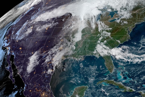
severe thunderstorms will rumble across a large swath of the United states on Monday into the evening, with the most destructive potential in the Upper Midwest.
On Monday, 36 million people are under the risk of severe storms from northern Minnesota to southwest Texas, where strong tornadoes, hail up to 2 inches in diameter and damaging straight-line winds are possible.
A tornado watch is in effect for northwest Iowa and parts of southwest Minnesota until 8 p.m. Thunderstorms are developing in the region, potentially producing a few strong tornadoes, large hail and wind gusts up to 80 mph through the evening.
Tornadoes may also hit Wisconsin and areas of Minneapolis; Kansas City, Missouri; Madison, Wis.; Omaha, Nebraska; Milwaukee; Oklahoma City; and Tulsa, Oklahoma.
"Have a plan in place," said Joe strus, an NWs meteorologist in the Twin Cities. "Know where to go if a warning is issued for your area. We're talking about an event today that can rapidly unfold, and you'll need to move pretty quickly into safety."
Officials in the Twin Cities are closely monitoring the weather system. Ramsey County Emergency Management and Homeland security Director Judd Freed told NBC affiliate KARE of Minneapolis that locals should have an emergency plan, have electronics fully charged and heed outdoor warning sirens.
"If you do hear those sirens tomorrow, stop what you’re doing if you’re outside — if you’re out in the park or wherever — start looking for some shelter and find out what’s going on," Freed said.
Over the weekend, at least one person died in flash flooding that hit Oklahoma. The Lawton Police Department said saturday the death came after a person drove into standing water.
Heavy rain in the region led to inundated roads, evacuation notices and water rescues.
The storm system behind Monday’s outbreak will continue east into Tuesday, with 45 million people at risk for severe storms from Texas to upstate New York. Large hail, strong winds and some tornadoes will be possible.
Across this area, there will be two regions with slightly higher chances of damaging storms: first, across West Texas into central Oklahoma, and second, across the Ohio Valley into the interior Northeast.
Tuesday's main threat is large hail. Heavy rain will hit the southern Plains and cause more flooding across Oklahoma, parts of north Texas and Arkansas into Wednesday.
Flash flooding will also be a concern into Wednesday, following repeated storms that are expected to dump 2 to 4 inches of rain from northern Texas to southern Missouri, with locally higher amounts of over 5 inches.
Cities that could see flooding Tuesday include Oklahoma City; Tulsa; and Wichita Falls, Texas. Cities that could experience flooding Wednesday include Texarkana, Texas, and Fayetteville, Arkansas.
On Wednesday, the next storm system will enter the Plains, leaving 8 million people at risk for storms capable of all hazards across northern Texas.

